Avalanche Problem Web Series:
Part 6 – Wet Slab
How to Apply the Avalanche Forecast to Your Riding
For splitboarders venturing into the backcountry, information can be the difference between an epic day and tragedy. In an effort to increase education and avalanche awareness, Spark R&D is presenting a 7-part web series called Avalanche Problems, which will explain the nationally standardized types of slides most commonly described in advisories by avalanche forecasters.
Understanding the characteristics of each type will help to determine where avalanches are likely to occur and what kind of terrain should be avoided. In today’s installment, we will cover Wet Slab Avalanches.
Wet Slabs in a nutshell
 In the springtime, the deep winter cold begins to lose its grip and the temperatures begin to rise. On a warm spring day (or during a rain event), the snow pack can become unglued and if a slab exists, there’s a good chance it will release. If there are known slabs, there is new spring snow, or persistent weak layers are lurking in the snow pack, the best strategy is to get out early and retreat when temperatures begin to rise. Be especially cautious if the temperatures don’t dip below freezing overnight.
What exactly is a wet slab avalanche?
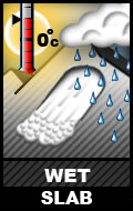
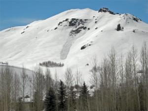
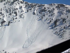
• Above freezing temperatures and/or rain cause a slab of snow to become unglued to the underlying surface. Wet slabs can be very destructive as the water in the snow pack means these slides are heavier and carry more mass.
• This is often a springtime problem, as temperatures generally stay cold enough mid-winter.
• The lifespan of wet slab avalanches completely depends on the weather. When temperatures cool off enough for the snow pack to re-freeze, than the problem will subside.
• When temperatures warm back up, the problem could come back.
• During long warm spells, the slab may entirely turn to mush and become a wet loose problem.
Where might you find wet slabs, and how to avoid them
• When wet slides occur, they tend to be fairly widespread.
![]() • The timing can vary throughout the day. Slopes facing easterly (NE, E, SE) get first sun; southerly slopes are late morning and mid day (SE, S, SW); and westerly slopes get the afternoon heat (SW, W, NW).
• The timing can vary throughout the day. Slopes facing easterly (NE, E, SE) get first sun; southerly slopes are late morning and mid day (SE, S, SW); and westerly slopes get the afternoon heat (SW, W, NW).
• Once the temperatures become too warm, stay off of steep terrain and avoid being caught underneath known slide paths.
• Rocks can intensify the heat, so be extra cautions as wet slides can initiate around them.
• Following the pattern of the sun works well, but once the air temperatures become too warm, it’s best to retreat all together.
How to look for and test for a wet slab
• Warning signs will start appear: Intense sun or above freezing temperatures, roller balls peeling away and running down slope, gloppy and mushy surface conditions, and natural avalanches.
 • Often times, this can be tied to warm sunny days preceding a spring storm (especially the day after).
• Pay attention to the weather history and the current weather conditions. Many warm days with a very light freeze or no freeze at night means the snow pack is not getting time to re-strengthen, and can be especially tender when the sun comes out.
Tips: Start early! In the springtime, don’t be afraid to get pre-dawn starts to beat the heat. The avalanche hazard can change very quickly, with safe conditions in the morning, and dangerous conditions once the heat turns on.
Disclaimer: Although characteristic, these descriptions are general, so make sure to read into any specifics mentioned on your local advisory. Also, this is just one piece of the puzzle, so remember to factor in the hazard rating and any field observations.
Find your local avalanche center: www.avalanche.org
Presented by Clark Corey
Splitboard Guide/Avalanche Educator


